ANNOUNCEMENTS

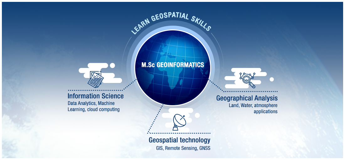
Master of Science in Geoinformatics at TERI SAS is a two years interdisciplinary program for students who want to develop expertise in and applying geospatial technologies to solve world’s most pressing real-world challenges in environmental, social and economic domains. Geoinformatics is a rapidly evolving field that brings meaningful insights to solve real world problems by bringing together technologies and tools required for acquisition, exploration, visualization, analysis and integration of various spatial data. There are several components of Geoinformatics that include cartographic geovisualization, GIS, Remote sensing, photogrammetry, spatial statistics, geostatistics, multivariate statistics and other advanced tools and techniques.
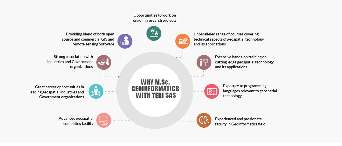
The core strength of the programme lies in its innovative curriculum that imbues present and future professionals on development and the use of cutting-edge geospatial technologies to emulate real-life problems. Over the period of two years, students gain sound knowledge in the scientific principles behind computational and analytical foundation of Geoinformatics as well as its applications in domains such as conservation biology, urban planning, meteorology and natural resource management through hands-on exercises, training programmes, 8 weeks summer internship, independent study and a semester long major project. Programme has flexible options for choosing elective courses across different departments that support students to build career in the domain of their interest.
• Extensive hands-on expertise: The programme provides extensive hands-on through courses and research projects relevant to the Geoinformatics domain.
• Exposure to state-of-the art tools and technologies: This programme provides exposure to cutting-edge tools and technologies such as latest remote sensing technology (e.g.,UAV), programming (e.g.,Python and R), database management like Oracle and MySQL, and other standard COTS and FOSS relevant to the field and other cross-cutting domains.
• Conceptual clarity: The programme provides conceptual clarity of the fundamentals to face the continuous technological advancements in the field of Geoinformatics.
• Capacity building: Capacity building of the students to face the technological advancements in the field of Geoinformatics and demonstrate confidence in undertaking new (unfamiliar) analysis.
• Leadership skills: This programme provides leadership skills in their respective field as well as in other cross-cutting domains.

The programme of geoinformatics has opened up the world of GIS and remote sensing for those who want to contribute to society through space applications. The programme not only strengthens the core theoretical knowledge of geoinformatics but also sharpens your capability to excel in this field. The faculty is very supportive and encourages you to push your limits. Guest lectures from various organizations such as ESRI, ERDAS, ISRO guide us to where this science can be used as a great tool. This programme is not just a coursework, but is valued by many organizations that are in search of proficient manpower in geoinformatics.

Today, the rising power of geospatial technology and remote sensing is being utilized in diverse fields such as agriculture, water resources, air quality and climate change. throughout the world. The upcoming opportunities in different research areas demand more and more GIS analysts with efficient skills. The implications of GIS knowledge in multi disciplines have already been reflected by previous batches of MSc. Geoinformatics passed out from TERI University. This course motivates students to work in research and development areas where they can exhibit their innovative ideas, high technical skills, experiences, learnings and independent projects.

Geoinformatics programme in TERI SAS gives equal emphasis on research as well as corporate aspects of the field which broadens the career scope for the students. My experience in TERI SAS was great. The MSc Geoinformatics programme covers all the requirements of geospatial industry. The curriculum is designed in such a way that it covers all the aspects of Geoinformatics from basics to advanced techniques with a focus on research. The minor project, independent studies and major project helped me in understanding the process of research. The courses offered in third semester of the programme such as Advances in Remote Sensing, Advances in GIS, Multivariate Statistics and independent studies really helped me in my professional growth. The faculty members are very supportive, knowledgeable and very good mentors. The classes were very interactive including group projects, presentations and group discussions which help in building confidence and team work among students. All the workshops, seminars and conferences organised by the Department were also really informative and useful for me in understanding the current developments in geospatial technology and industrial needs which further helped me during my major project and job interviews.


Spatial and non-spatial datasets are crucial for studies on environmental and sustainable development planning., The emerging need of geospatial technology has created an unprecedented demand of trained manpower, who can contribute to production and analysis of these datasets. To fulfil the need of such trained professionals, the MSc in Geoinformatics offers a cutting-edge technology, which has the potential of providing consistent and timely information required for natural resource management. The programme, offered by the Department of Natural Resources, is intended to educate students and professionals about Remote Sensing/Geographical Information System/Global Navigation Satellite System and spatial modelling techniques. It also offers elective courses that help students in understanding the interdisciplinary applications of this ever-evolving technology. Students who complete this programme will possess the confidence and skills to attract a wide range of potential employers in both public and private organizations.
| Year | Courses | Credits | Duration* |
| First Year | |||
| 1st Semester | 8 core courses of 2-4 credits each | 21 | 15 weeks |
| 2nd Semester | 6 core courses of 2-4 credits each | 20 | 15 weeks |
| Semester | Minor project | 8 | 8 weeks |
| Second Year | |||
| 3rd Semester | 2 core courses of 4 credits each and 2 elective courses of 3 credit each | 14 | 15 weeks |
| 4th Semester | Major project | 20 | At the location of the project |
* Does not include mid and end-semester breaks and evaluation schedules (based on major and minor tests and assignments)
| Semester 1 | ||||||
| Course No. | Course Title | Type | Number of Credits | No. of L-T-P | Course Coordinator | Course Offered |
| NRE 106 | Communication skills and technical writing | Core | 2 | 16-14-0 | Yes | |
| NRE 113 | Applied mathematics | Core | 0 | 33-12-0 | Dr Amit Singh | Yes |
| NRG 103 | Project management | Core | 3 | 30-15-0 | Dr Amit Moza | Yes |
| NRG 106 | Fundamentals of computers and programming | Core | 2 | 12-4-28 | Mr. Kapil Dev | Yes |
| NRG 168 | Satellite Meteorology | Core | 3 | 28-10-14 | Dr Adil Masood | Yes |
| NRG 169 | Principles of remote sensing | Core | 4 | 36-8-32 | Dr Chandrashekhar Azad Vishwakarma | Yes |
| NRG 171 | Principles of cartography | Core | 3 | 22-8-30 | Dr B. K. Bhadra | Yes |
| NRG 176 | Principles of GIS & GNSS | Core | 4 | 42-2-32 | Dr Ayushi Vijhani | Yes |
| Semester 2 | ||||||
| Course No. | Course Title | Type | Number of Credits | No. of L-T-P | Course Coordinator | Course Offered |
| NRE 115 | Environmental statistics | Core | 4 | 42-18-0 | Dr Adil Masood | Yes |
| NRE 123 | Biodiversity Assessment and Conservation | Elective | 3 | 20-15-20 | Mr. Akash Jaiswal | Yes |
| NRE 162 | Hydrology | Elective | 3 | 30-15-0 | Dr Ranjana Ray Chaudhuri | Yes |
| NRE 173 | Research methodology and thesis writing | Elective | 2 | 28-2-0 | Dr Pritha Datta | Yes |
| NRG 108 | Programming in geoinformatics | Core | 3 | 15-5-50 | Dr Adil Masood | Yes |
| NRG 162 | Law and policy for maps and remote sensing | Core | 2 | 30-0-0 | Dr Kavita | Yes |
| NRG 163 | Spatial data modelling and its applications | Core | 4 | 36-8-32 | Dr Ayushi Vijhani | Yes |
| NRG 170 | Photogrammetry | Core | 3 | 26-4-30 | Dr B. K. Bhadra | Yes |
| NRG 172 | Digital image processing and information extraction | Core | 4 | 34-10-32 | Prof. Chander Kumar Singh | Yes |
| Semester 4 | ||||||
| Course No. | Course Title | Type | Number of Credits | No. of L-T-P | Course Coordinator | Course Offered |
| NRG 112 | Major Project | Core | 20 | 0-0-600 | Dr Adwitiya Sinha | Yes |
For past program/course outline see: Archive M.Sc.(Geoinformatics)
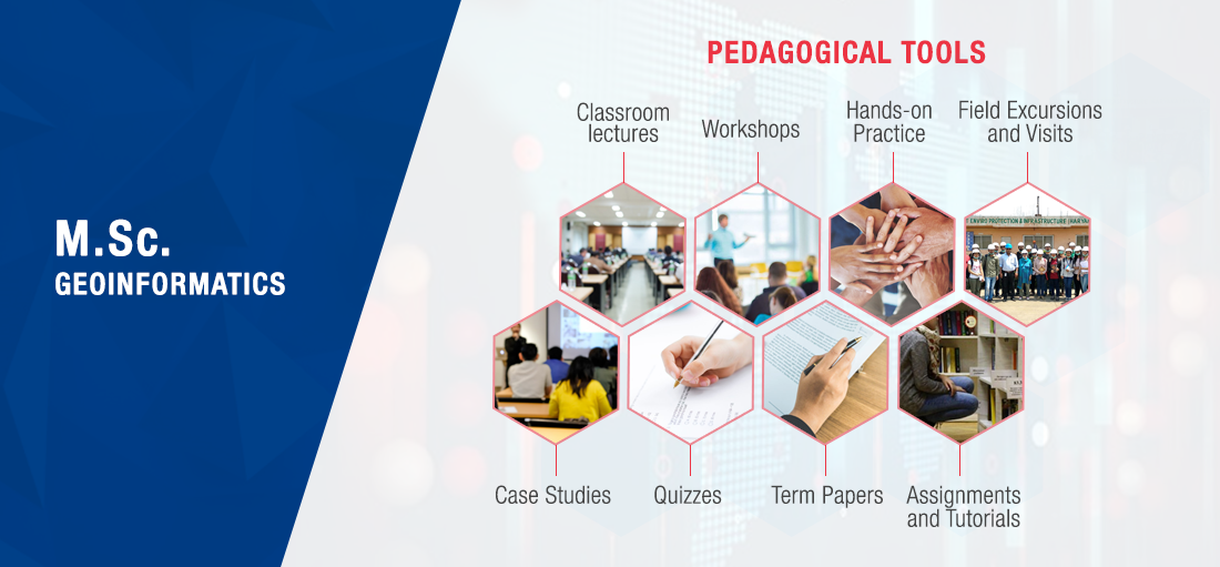
The pedagogical tools will comprise of formal class room teaching, workshops, hands-on practice, field excursions, case studies, field visits, quizzes, term papers, assignments and tutorials. Group and individual projects using diverse spatial-temporal datasets will be used to demonstrate specific issues of environmental and social sciences. Interactive sessions will be arranged with players and stakeholders in data management and plan execution from the government, private sector, entrepreneurs and NGOs.
The introduction of this new Student Output/ Major Project section aims at highlighting the exceptional work done by our students during their Major Projects.
Laying strong emphasis on practical knowledge, Major Project at TERI SAS is a mandatory exercise in which the students work with industry to gain real-world work experience.
The 16-20 week-long Major Project prepares the students for real-world work environment followed by submission of an academic thesis for evaluation.
It’s hard to categorize the work of our students as all our students put extreme hard work to make their Project better than their peers. But there is always a place for exceptional work that stands out and calls for attention.
Here are some inspirational Major Project outputs by our students which not only stand out but have also left a deep impact on socio-economic aspects of people’s lives in general.
Plot No. 10, Institutional Area, Vasant Kunj, New Delhi - 110 070, India.
Tel. +91 11 71800222 (25 lines).
Website : www.terisas.ac.in
Email id : registrar@terisas.ac.in
© Copyright © 2025, TERI SAS, All rights reserved.
Visitors No.: 47692955 Since 2023

